District Hain
Data and facts
| Name of the district: | Hain |
| with the localities: | Hain, Wacholderbaum |
| District of the city of Gera since: | 10.08.1994 |
| Surface area: | 258 ha |
| Population: (as at: 31.12.2022) | 200 |
Location and transport connections
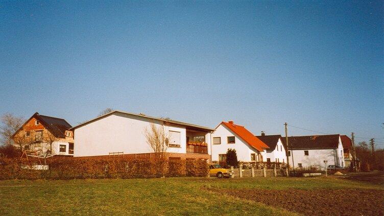
| Location: | Hain is located in the northern part of the town directly on the B2 at an altitude of 300 m on the northern valley edge of the lower Brahmetal. |
| Utilization: | The existing established village locations are strongly village-like in character and reflect the historical combination of agricultural and residential use in terms of design. The "Pioneer Battalion 701" military base is located on the Hungerberg or Galgenberg. |
| Landscape and site design: | Im östlichen Teil von Hain befindet sich eine morphologisch bewegte Fläche. Das Landschaftsbild ist geprägt von Acker- und Wiesenflächen. Die Einbindung der gewachsenen Ortslagen in den Landschaftsraum ist aufgrund der starken Durchgrünung mit landschaftstypischen Gehölzen gegeben. Die Straßenstruktur ist dörflich geprägt. Am Rande von Hain entstand ein kleines Wohngebiet; die ursprüngliche Bebauungsstruktur der Ortsteile ist durch viele landwirtschaftliche Hofanlagen (z.B. Vierseitenhof) geprägt. |
| Transport connections: | Hain and Wachholderbaum can be reached via the B2. The inner connection is via municipal roads. Hain can be reached by public transport with the bus lines 228 or 229 of Regionalverkehr Gera/Land GmbH after changing at the "Duale Hochschule" transfer point in Tinz. |
History
(Author: Roland Meinecke)
Hain is one of the smaller districts in the city of Gera. Trade and commerce are only weakly developed. Agriculture is of economic importance. The agricultural land is mainly farmed by the Trebnitz agricultural cooperative and the Knorre farm.
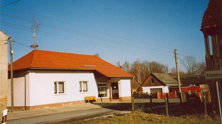
The district of Hain has a beautiful clubhouse, which is run by the fire department association. Hain has a beautiful, quiet location and is known as a hiking destination. From the plateau, there is a particularly beautiful view over the town of Gera towards Weida as far as Hohenleuben. The abundant ponds in the Hain area are populated almost all year round with numerous wild ducks, which are happy to be fed.
Hain was probably mentioned in documents as early as 1191. As part of the Langenberg administration, Hain, together with Röpsen and part of Roschütz and Dorna, ultimately came into Wettin ownership after its dissolution and remained there as part of the Duchy of Saxony-Altenburg until the formation of the state of Thuringia in 1920.
Hain was closely connected to Röpsen. The school, church and cemetery were used jointly. The village was economically dominated by the manor until the land reform in 1946. With brief interruptions, it was owned by the von Schauroth family for a long time. Carl Friedrich von Schauroth, the last Saxe-Gotha colonel of the Land Regiment and owner of the estate for 34 years from 1693, deserves special mention. He was obviously financially well off. It was during this time that the "Kempe", an old fortified building, was converted into a well-furnished chapel and the former small baroque garden was laid out.
He was also responsible for the creation of the village of Wachholderbaum. In 1788, the farm buildings of the manor burned down completely as a result of a lightning strike and had to be rebuilt.
From 1807, the von Brandenstein family owned the manor, which was sold to the town of Gera in 1935, together with all the properties. The city of Gera then sold large parts of the property, except for the buildings, to the German Reich, which became a military training area until 1945. The military use was then remembered again in the 1950s.
Along with the existing buildings, the manor chapel also remained in the ownership of the town. The building had considerable structural defects and repairs were urgently needed. Neither the state nor the town of Gera were willing to provide the necessary funds. In 1938, the manor chapel, including the funeral chapel, was demolished. A valuable, historic building was lost forever, especially as the cross-vaulted substructure of the old "Kempe" had been preserved after its conversion into a church. The loss of this very old building fabric is particularly upsetting.
While the nobility could afford a modest level of luxury, the living conditions of the other inhabitants in the village were very hard. Their livelihood was secured by working on the estate and from the meagre results of their own farming. Their own fields were small and the soil was poor. With the advent of industrialization, new employment opportunities arose, but no one became wealthy.
At the time of the land reform, all the properties of the former manor were divided up, most of the buildings were demolished and the demolition material was used to build 10 new farms. Of the 10 settlers, three came from Silesia, one from the Sudetenland and 6 from the municipality. In the following decades, 9 settlers gave up the new farmsteads for various understandable reasons. The land was then farmed cooperatively.
From 1945 to 1990, the community tried to improve living conditions. The central water supply, consumption and the nurses' station should be mentioned as examples, as well as efforts to improve the condition of the roads.
Wachholderbaum, previously a temporarily independent community, became part of Hain during this time. In 1990, the community of Hain regained the right to local self-government. This period also marked the beginning of the renovation of the no longer used consumer goods in the clubhouse.
Due to the law on the reorganization of districts and independent cities in Thuringia of August 16, 1993, the former municipality of Hain was incorporated into the city of Gera against its will after exhausting all legal means. The fire brigade association organizes regular festivals for young and old throughout the year.
In the OT Wachholderbaum there is a holiday home for fitters or families to stay. Daily necessities or Sunday rolls are available in the neighboring town of Langenberg.


